Grampians National Park, also known as Gariwerd, is all about big rock and wide sky. This guide brings together seven standout walks so you can match a track to your fitness and time. Some stay easy near town while others climb over rough sandstone to high lookouts. Each walk includes clear notes on terrain and effort to help you choose quickly. Pack water with a hat and sturdy shoes then set out to enjoy the best walks in the Grampians.
Pinnacle Circuit
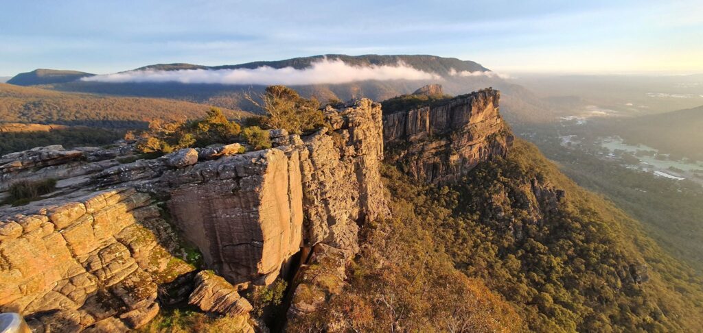
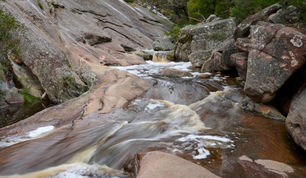
This walk starts in Halls Gap and goes past waterfalls, rocky gullies and the Grand Canyon before climbing up to the Pinnacle lookout. The track is rough in spots with some scrambling, steep steps and uneven ground that can be slippery when wet, so good shoes are important. You’ll pass through bush, creeks and big rock formations. The climb can feel hard at times but most people can manage it. The views over Halls Gap at the top are worth the effort. It’s best to go early in the morning if you want some quiet time on the trail.
| Distance | 8 km circuit |
| Difficulty | moderate |
| Start from | Halls Gap |
| Map and more photos |
The Grand Canyon and the Pinnacle
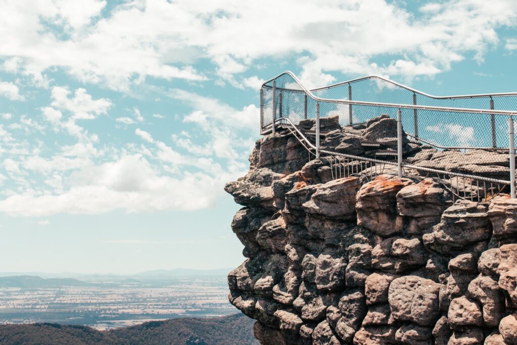
Start at the Wonderland carpark and follow a clear path into a rocky gorge with cool slot canyons. There are rock steps and a couple of easy scrambles so good shoes help. The climb is steady with a few steep bursts that get the legs working but most people with moderate fitness will be fine plus older kids who enjoy a bit of clambering. Views open up along the way then the final lookout spreads the range and valley in front of you which feels like a big reward. Summer gets busy so go early or pick winter for quieter tracks and softer light. After rain the rock can be slippery so take it slow in the canyon sections and carry a wind layer for the top. Plenty of spots to pause for photos through the gorge although the last platform is the one you will remember.
| Distance | 4 km return |
| Estimated Time | 3 hours |
| Difficulty | moderate |
| Start from | Wonderland car park |
| Map and more photos |
Chatauqua Peak & Clematis Falls
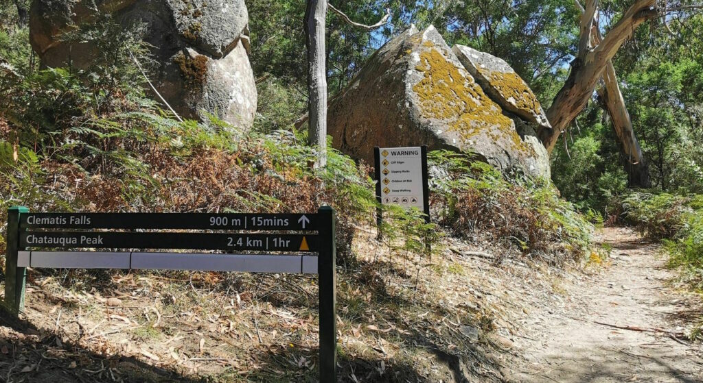
Starting at Halls Gap Picnic Area, the track eases through quiet forest with chances to spot kangaroos and wallabies. The climb finishes with a short rock scramble near the top so a moderate fitness level helps. From the high point the view rolls over Halls Gap to Lake Bellfield with the Wonderland and Serra ranges on the skyline. After rain Clematis Falls puts on a show though the trail can turn muddy and slippery so wear shoes with good grip. The return dips into the cool fern gully at Bullaces Glen then passes old logging remains back toward town. Go early for softer light and fewer people.
| Distance | 6.3 km circuit |
| Estimated Time | 2.5 hours |
| Difficulty | moderate |
| Start from | Halls Gap |
| Map and more photos |
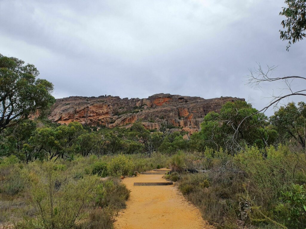
Mount Rosea
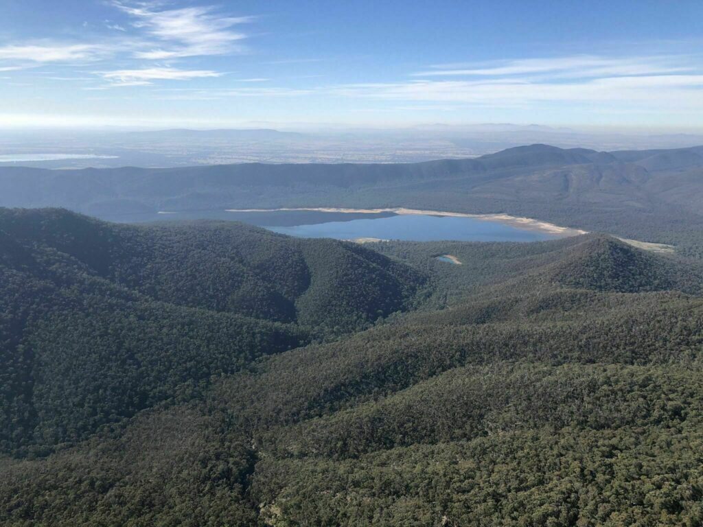
Expect a steady climb through peppermint gums that soon turns rocky as the path rises to a narrow ridgeline. The track is well formed yet calls for rock hopping and a few hands-on moves through gaps and under big blocks plus a short footbridge over a deep crack that feels exposed. Good boots help since the stone can be slippery after rain. Best for hikers with solid fitness not ideal for small kids or anyone uneasy with heights. The payoff is wide views over the Serra and Mount William ranges with sculpted cliffs and caves all around. Emus and wallabies often roam the lower slopes. Start early in the cooler months for calmer weather and fewer people. Follow the markers, take a quick photo at the natural rock gateway near the top and watch your footing on the descent.
| Distance | 8.9 km return |
| Difficulty | hard |
| Start from | Rosea carpark |
| Map and more photos |
Venus Baths
Easy loop from the heart of Halls Gap on a formed track along Stoney Creek past the towering sandstone of ‘Elephant Hide’ and the botanic garden. Venus Baths are shallow sandstone rock pools carved by Stoney Creek with wide smooth slabs that suit a quick paddle in warm weather. The path stays mostly flat with a few steps though rocks near the water can be slippery after rain. Good for families and young kids under close supervision. Expect quiet bush with escarpment views plus impressive boulders and clear pools.
| Distance | 1.9 km circuit |
| Estimated Time | 1 hour |
| Difficulty | easy |
| Start from | Halls Gap |
| Map and more photos |
MacKenzie Falls
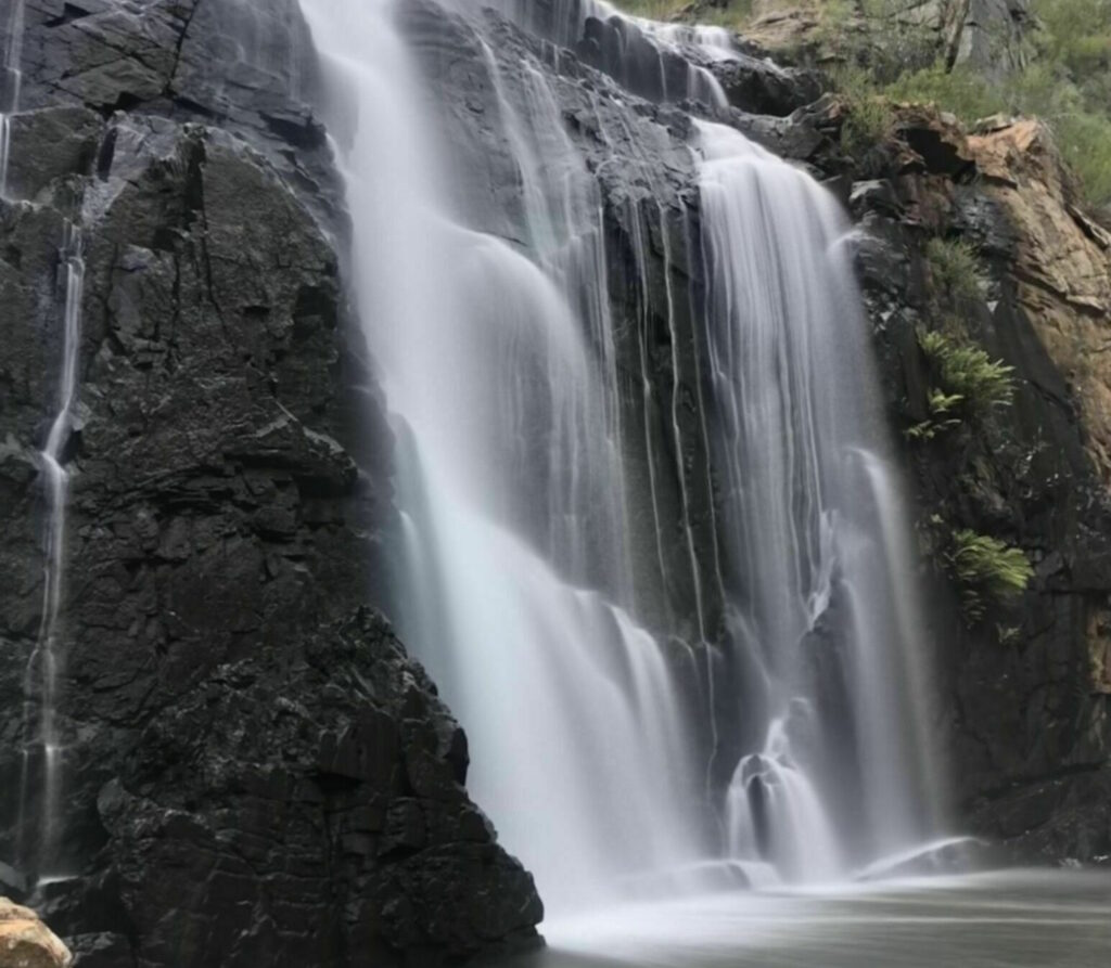
Start with the easy path to the upper lookout. It’s smooth underfoot and works for prams and wheelchairs. The big waterfall runs all year so the view delivers even in summer. If you want more drop to the base on about 260 stone steps with rails. The path narrows in spots and gets slippery in rain. The climb back up is a grind so bring water and decent shoes. Fit walkers and older kids do well while little ones may prefer the top only. Go early for a quieter visit since this place gets busy. The mist at the bottom feels great on hot days. You can follow the river to another small waterfall if you’ve got energy. Quick tip: step past the main platform to the metal grate path for a better angle.
| Distance | 1.3 km return |
| Estimated Time | 30 minutes |
| Difficulty | moderate |
| Start from | McKenzie Falls car park |
| Map and more photos |
Hollow Mountain / Wudjub-Guyun
This hike starts as an easy bush track then turns into a steep scramble over rough sandstone to a rocky dome with pockets and caves. Grippy shoes help on smooth slabs that turn slippery when dusty or wet. The route suits confident hikers with good fitness not small kids. Wide views reach over ridges and farmland with sculpted cliffs close by. No shade on the rocks so take a hat and sunscreen. Quick detours into the caves make good photo spots.
| Distance | 2.4 km return |
| Estimated Time | 2 hours |
| Difficulty | hard |
| Start from | Hollow Mountain car park |
| Map and more photos |